
County maps - 2014 revision
Interactive map | List of counties
The Wisconsin Department of Transportation is pleased to provide highly detailed county maps online. Produced at a 1:100,000 scale, the maps contain the following pieces of information:
|
|
The maps are color Adobe PDF files at 11" x 17" size. They are single county productions only and not designed to act as a foldable roadmap.
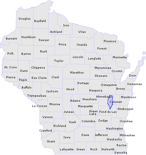
Click the desired county on the map below to see its detailed view or choose from an alphabetical county list.
Important: The following document(s) are in Adobe PDF
 format.
(Note: Some files are large and may take
longer to download depending on individual connection speeds. Users
may need to zoom in to see details.)
Wisconsin county maps
(listed alphabetically)
For printed (black and white)county map booklets
contact:
"Map and Publications Sales" DOT Map Sales
3617 Pierstorff Street (Truax Field)
P.O. Box 7713
Madison, WI 53707
(608) 246-3265
Questions about the content of this page:
Ken Cowan, kenneth.cowan@dot.state.wi.us
or
Bill Schloemer, william.schloemer@dot.state.wi.us
Last modified: June 9, 2014
[an error occurred while processing this directive]