
Wisconsin county bike maps
These county bike maps provide a bicycling conditions assessment that benefits both cyclists and transportation planners. Information about how to use the maps with a detailed legend and description of the bicycling conditions is available. These maps utilize 2009 traffic and roadway data and are part of the 2010 Wisconsin State Bicycle Map.
The conditions for cycling represented on the map are intended for an average adult cyclist with at least some experience operating on higher speed roadways. The maps are presented in color as Adobe PDF files, and are printable on 8.5" x 11" (or larger) size paper. Since the bicycling conditions are presented in color, the maps should be printed in color as well. Zooming in and printing a section of a county map will provide you with the most useful print product. Some of the PDF files are large and may require a lengthy download time. For a regional or state perspective beyond county borders, the Wisconsin State Bicycle Map will be of greater benefit to you. Unlike the county maps, the State Bicycle Map includes topography.
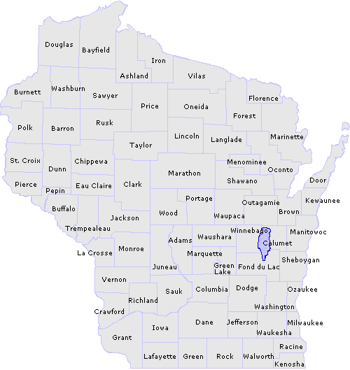
Click the desired county on the map below to see its detailed view or choose from an alphabetical county list. Many of the larger counties have been split in half to provide smaller files and more usable print copies.
Wisconsin county maps
The PDF ![]() files are large and may require a lengthy download time.
files are large and may require a lengthy download time.
(listed alphabetically)
|
Adams
(3.8 MB) Ashland north (3.0 MB) Ashland south (1.8 MB) Barron (2.9 MB) Bayfield north (1.4 MB) Bayfield south (3.6 MB) Brown (2.3 MB) Buffalo (3.9 MB) Burnett west (1.2 MB) Burnett east (2.4 MB) Calumet (1.0 MB) Chippewa west (3.2 MB) Chippewa east (3.4 MB) Clark north (2.6 MB) Clark south (1.8 MB) Columbia (2.5 MB) Crawford (2.9 MB) Dane west (2.2 MB) Dane east (1.8 MB) Dodge (2.8 MB) Door north (739 KB) Door south (646 KB) Douglas north (2.5 MB) Douglas south (2.8 MB) Dunn (3.1 MB) Eau Claire (2.2 MB) Florence (1.5 MB) Fond du Lac (2.7 MB) Forest north (2.0 MB) Forest south (2.3 MB) Grant (3.4 MB) Green (1.6 MB) |
Green Lake
(3.2 MB) Iowa (2.7 MB) Iron (3.3 MB) Jackson west (2.1 MB) Jackson east (2.1 MB) Jefferson (1.6 MB) Juneau north (3.0 MB) Juneau south (1.8 MB) Kenosha (929 KB) Kewaunee (1.3 MB) La Crosse (2.8 MB) Lafayette (2.1 MB) Langlade (3.2 MB) Lincoln (3.5 MB) Manitowoc (1.8 MB) Marathon west (2.8 MB) Marathon east (2.9 MB) Marinette north (3.5 MB) Marinette south (2.8 MB) Marquette (1.6 MB) Menominee (1.5 MB) Milwaukee (1.3 MB) Monroe (3.3 MB) Oconto west (3.4 MB) Oconto east (1.7 MB) Oneida west (4.3 MB) Oneida east (3.9 MB) Outagamie (2.1 MB) Ozaukee (1.2 MB) Pepin (2.6 MB) Pierce (2.1 MB) |
Polk
(3.5 MB) Portage north (5.6 MB) Portage south (3.8 MB) Price north (2.8 MB) Price south (2.4 MB) Racine (1.3 MB) Richland (2.1 MB) Rock (1.8 MB) Rusk (3.2 MB) Sauk (4.2 MB) Sawyer north (4.3 MB) Sawyer south (3.5 MB) Shawano (3.2 MB) Sheboygan (1.7 MB) St. Croix (2.8 MB) Taylor (3.0 MB) Trempealeau (3.9 MB) Vernon west (3.0 MB) Vernon east (2.0 MB) Vilas west (3.7 MB) Vilas east (3.8 MB) Walworth (1.5 MB) Washburn north (2.9 MB) Washburn south (2.7 MB) Washington (1.7 MB) Waukesha (2.1 MB) Waupaca north (3.5 MB) Waupaca south (4.1 MB) Waushara (3.7 MB) Winnebago (2.3 MB) Wood (3.8 MB) |
Questions about the content of this page:
Dan Thyes, dan.thyes@dot.wi.gov
Last modified: May 15, 2014
[an error occurred while processing this directive]